Image: Shutterstock
About This Quiz
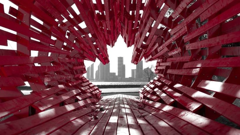
Canada is a vast and beautiful country. How much do you really know about its people and its landscape? Test your knowledge with this Canadian geography quiz!
In terms of area, where does Canada rank among sovereign states?
the largest
the second largest
Apart from Russia, Canada is the world's second-largest nation. (Antarctica is technically bigger than Canada, too.)
the third largest
Advertisement
How much of North America does Canada encompass?
nearly 70 percent
roughly half
about 40 percent
Canada makes up about 2/5ths of the area of North America. But don't be fooled; there aren't a lot of people in all that vast space.
Advertisement
How many islands does Canada include?
none
two
thousands
Canada's coasts are loaded with islands. The Arctic region is largely made up of islands.
Advertisement
What's one famous island in Canada?
Newfoundland
New Brunswick and Nova Scotia are both provinces. Newfoundland is an island -- and it's part of the Newfoundland and Labrador province.
Nova Scotia
New Brunswick
Advertisement
Canada's southernmost point is the same latitude as what?
Washington state
Maine
Northern California
The latitude of Middle Island in Lake Erie is the same as Northern California, and is more southern than numerous U.S. states.
Advertisement
What is NOT a Canadian province?
Prince Edward Island
Nunavut
Northwest Territories, the Yukon and Nunavut are technically territories. Alberta, British Columbia, Manitoba, New Brunswick, Newfoundland and Labrador, Nova Scotia, Ontario, Prince Edward Island, Quebec and Saskatchewan are all provinces.
Alberta
Advertisement
The Maritime Provinces include what?
New Brunswick
Prince Edward Island
New Brunswick, Prince Edward Island and Nova Scotia are sometimes called the "Maritime Provinces." The Atlantic Provinces consist of the Maritime Provinces, plus Newfoundland and Labrador.
both
Advertisement
What is NOT included in the Prairie Provinces?
British Columbia
Alberta, Manitoba and Saskatchewan make up the Prairie Provinces. All three -- plus British Columbia -- encompass the Western Provinces.
Manitoba
Alberta
Advertisement
Canada consists of how many geographical regions?
two
four
six
There are six major geographical regions in Canada. And don't you worry, you're about to learn about all of them.
Advertisement
The Canadian Shield is the biggest geographic region. How much of the country does it occupy?
about half
The Canadian shield covers about half of Canada's area, and is centered around Hudson's Bay.
about three-quarters
one third
Advertisement
What is a defining feature of the Canadian Shield?
a lot of rock
The Canadian Shield consists of Precambrian igneous rock, and a lot of it is some of the oldest rock on Earth. While they used to form huge peaks, today they've been eroded down.
extremely fertile soil
beaches
Advertisement
What large lake is in the Canadian Prairie region?
Lake Huron
Lake Jerome
Lake Winnepeg
Lake Winnepeg is in Manitoba, and is the largest lake in southern Canada. Just don't confuse it for Lake Winnipegosis -- a smaller (but cooler-named) lake right next to it.
Advertisement
A flat plain makes up the Great Lakes-St. Lawrence lowlands. What caused it?
an earthquake around 15 CE
no one knows -- maybe dinosaurs stomped real hard there?
a huge flood during the last glacial period
While dinosaurs are mysterious, they don't mysteriously cause plains to form. A flood of ocean water caused the flat plain to form.
Advertisement
What North American formation lends its name to another Canadian geographical region?
Appalachian Mountains
The Appalachian Mountains extend all the way from Alabama into Canada. This region contains rocky formations and rounded hills -- not unlike the U.S. Appalachian region.
the Rocky Mountains
The Columbia River
Advertisement
What is a cordillera?
a huge delta
a system of parallel mountain ranges
The Western Cordillera region of Canada includes the Canadian Rockies, but extends to the Pacific Ocean.
a large bay
Advertisement
Which mountains in Canada are older -- the Appalachian or the Rockies?
Appalachians
The Appalachians are older -- they are not as high and angular, meaning they've been eroded more. The peaks of the Rockies are quite tall and sharp.
Rockies
It's entirely unknown and impossible to tell.
Advertisement
The Western Cordillera also consists of what mountain range?
the Olympics
The Coast Mountains
While all three of those ranges are in the Pacific Mountain system, it's the Coast Mountains that are part of the Western Cordillera.
the Cascades
Advertisement
Is Canada part of the Pacific Ring of Fire?
no
yes
It is dangerous! The Pacific Ring of Fire is a system of volcanoes and earthquakes occur. The area skirts around the basin of the Pacific Ocean, and you bet Canada is a part of it.
I hope not -- sounds dangerous.
Advertisement
How big is the Arctic Archipelago?
50,000 square miles
550,000 square miles
Yup, it's a pretty big area of Canada. Predictably, it's mostly covered in ice and snow.
a million square miles
Advertisement
So just to refresh our memories . . . what's an archipelago, again?
a large island
a mountain system
a group of islands
Hey, no shame if you couldn't remember. The Arctic Archipelago consists of thousands of islands.
Advertisement
Canada has how much of the world's accessible fresh water?
less than one percent
four percent
almost 15 percent
That's right, Canada has 1/7 of the world's fresh water. It's mostly in the numerous lakes and wetlands that cover the nation.
Advertisement
What is Canada's longest river?
Mackenzie River
The Mackenzie River flows over 2,600 miles. From the Arctic, the Mackenzie drains into Great Slave Lake in the Northwest Territories.
Fraser River
Columbia River
Advertisement
What is the tundra?
ice-covered soil
an area of treeless ground above the timberline
OK, it is a type of truck too. But more than that, the tundra is a vast area that can't support much tree, plant or animal life.
a type of truck
Advertisement
What do you find in tundra areas?
permafrost
Permafrost is just that -- permanently frosted ground. The permafrost of the tundra stays frozen year-round.
lots of bird and insect life
a large population
Advertisement
What DOES grow in the tundra?
lichens and mosses
Hey, don't mock some lichens and moss. They can support all sorts of little animals and insects that help keep the food chain thriving.
in the summer, large flowers bloom
huge cedar trees
Advertisement
Canada is second only to Russia for what distinctive geographic feature?
the world's largest uninterrupted forest
If there was an objective way to measure "general snow and cold," Canada would probably be in competition. But it comes in second for the most boreal forest area.
huge sand dunes
just general snow and cold
Advertisement
Cool! Boreal forests! Er, what's a boreal forest?
a forest that's usually in frozen temperature
a forest that largely consists of coniferous trees
A boreal forest is also called taiga, from the Russian name. In Canada, the taiga produces lumber and products, but it's also pretty hard to have access to the northernmost parts.
a forest that is not inhabited
Advertisement
What other kinds of forests exist in Canada?
broadleaf forests
rainforests
both
That's right! Canada doesn't just have coniferous and broad-leaf forests. It also has temperate rainforests in the British Columbia region.
Advertisement
What's the largest lake enclosed in Canada?
Great Bear Lake
The Northwest Territories lake has many rivers flowing into it, including the Whitefish and the Big Spruce. Great Slave Lake is the second-largest.
Great Slave Lake
Lake Huron
Advertisement
How much of the world's population does Canada have?
less than one percent
It's a lotta land -- and geography -- for not many people. But Canada's vast area might just be more valuable because it is so sparsely populated.
two percent
four percent
Advertisement
You Got:
/30
Shutterstock